
| name | named after | image | city | administrative división | country | continent | Length (m) | Width (m) | place | latitude (°) | longitude (°) | date creation | Map |
|---|---|---|---|---|---|---|---|---|---|---|---|---|---|
| Donegall Road |  | Belfast | Northern Ireland | United Kingdom | Europe | 54.5886000000 | -5.9567000000 | Map | |||||
| Falls Road, Belfast |  | Belfast | Northern Ireland | United Kingdom | Europe | 54.5935000000 | -5.9582300000 | Map | |||||
| Malone Park |  | Belfast | Northern Ireland | United Kingdom | Europe | 54.5674000000 | -5.9582600000 | Map | |||||
| Sandy Row | 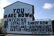 | Belfast | Northern Ireland | United Kingdom | Europe | 54.5920000000 | -5.9370000000 | Map |